Stand on Franconia Ridge on the right morning and you might watch a cloud bank roll up out of the Pemigewasset Wilderness and swallow the trail in front of you in about ninety seconds — then, just as fast, tear open to reveal Mount Lafayette glowing in the morning sun like someone flipped a switch. That's the Whites in a nutshell: they'll humble you and hand you the best view of your life in the same ten minutes.
New Hampshire's White Mountains — the Presidential Range and its neighbors — are a cheat code: real alpine terrain, above-treeline exposure, and hut-to-hut infrastructure you'd normally have to fly to Europe for, all within a few hours of Boston. Here are the day hikes hikers keep coming back to, from a mellow first-timer ledge walk to the biggest, baddest summit in the Northeast.
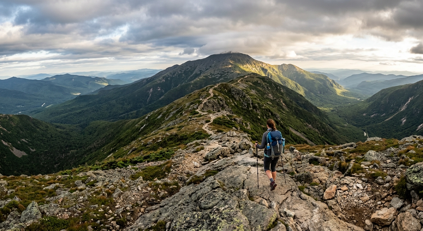
Franconia Ridge Loop (Mount Lafayette and Mount Lincoln)
Distance: 8.6 miles | Elevation gain: ~3,900 feet | Time: 6-8 hours
If we could only do one hike in New Hampshire for the rest of our lives, this is it. The classic loop goes up the Falling Waters Trail (which saves its best for the 80-foot plunge of Cloudland Falls), pops out above treeline at Little Haystack, then runs nearly two miles of open ridgeline over Mount Lincoln (5,089 feet) to Mount Lafayette (5,260 feet) before dropping down past AMC's Greenleaf Hut on the Old Bridle Path.
That ridge section is the whole show. You're walking a rocky catwalk with Franconia Notch dropping away on one side and the Pemi Wilderness rolling out on the other. In perfect September sun or in sideways mist, it's worth it either way — though on a clear day it might be the best two miles of trail east of the Rockies.
The catch: everyone knows it. The Lafayette Place trailhead lot on I-93 fills by 7 a.m. on summer weekends, and the state now runs a reservation system for peak days. Get there stupidly early, have a weekday up your sleeve, or take the Franconia Notch shuttle. And go counterclockwise (up Falling Waters, down Old Bridle Path) — the wet rock on Falling Waters is much friendlier going up than coming down. Greenleaf Hut, about a mile below Lafayette's summit, sells lemonade and baked goods in season. Nobody walks past without stopping.
Mount Washington via Tuckerman Ravine
Distance: 8.4 miles round trip | Elevation gain: ~4,250 feet | Time: 7-9 hours
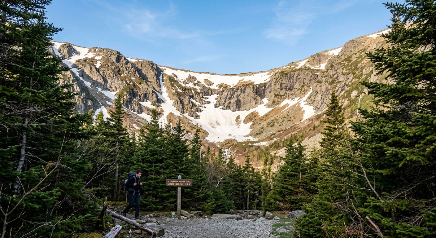
The big one. Mount Washington (6,288 feet) is the highest peak in the Northeast, and the Tuckerman Ravine Trail from Pinkham Notch is the classic way up on foot. The first 2.4 miles to Hermit Lake are a steady rocky grind, and then the headwall rears up in front of you — a glacial cirque so steep it holds snow into June. The trail climbs straight up it on rock steps and slabs, and the last mile above the ravine is a boulder hop through genuine alpine tundra, following cairns to the summit.
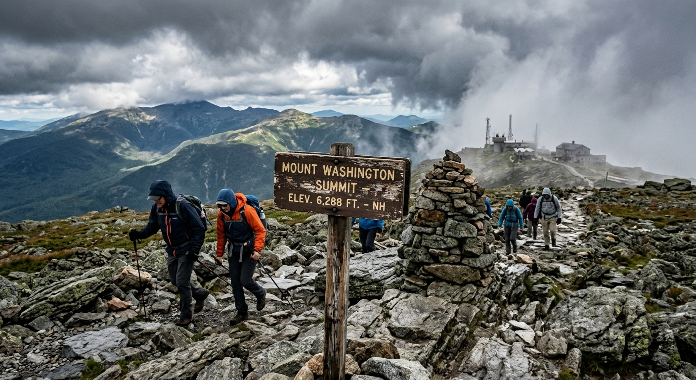
Two honest warnings. First, the summit has a road, a cog railway, a snack bar, and a parking lot, so you'll crest the rockpile after four hours of effort and get in line for photos behind someone in flip-flops. Make peace with that now; the hike itself is still magnificent. Second — and we can't stress this enough — Mount Washington's weather is famously, statistically dangerous. The observatory up top recorded a 231 mph wind gust in 1934, summer summit temperatures sit in the 40s and 50s on a *good* day, and hypothermia cases happen every single July. Dozens of people have died on this mountain. Check the Mount Washington Observatory's higher summits forecast the morning of your hike, carry a real shell and warm layers no matter what the valley feels like, and turn around at Hermit Lake if the forecast has gone sideways. The mountain will be there next weekend.
If the headwall is closed (common in late spring due to snowmelt and falling ice), the Lion Head Trail is the standard detour — steeper, but with better views the whole way up.
Mount Washington via Ammonoosuc Ravine and Lakes of the Clouds
Distance: ~9 miles round trip | Elevation gain: ~3,800 feet | Time: 7-9 hours
Our favorite way up Washington, and the one we recommend to strong hikers who want fewer crowds than Tuckerman. From the Cog Railway Base Station on the west side, the Ammonoosuc Ravine Trail climbs gently along the river for a mile and a half, then goes straight up — slabs, ladder-steep rock, and waterfalls right beside the trail — until you pop out at AMC's Lakes of the Clouds Hut at 5,012 feet, sitting beside two tiny alpine tarns with the summit cone looming behind. From the hut it's 1.4 miles up the Crawford Path, the oldest continuously maintained footpath in America, to the top.
The hut is the move here. Grab soup and a slab of fresh bread, refill your bottles, and check the weather board before committing to the summit. On the way down, most people either retrace their steps or descend the Jewell Trail for a mellower (if slightly longer) grade back to the Base Station lot. That lot is paid parking and fills on weekends, but it turns over less frantically than the east side.
Mount Adams and Mount Madison via the Airline
Distance: 9.6 miles round trip (Adams) | Elevation gain: ~4,500 feet | Time: 8-10 hours
For our money this is the hardest — and most rewarding — day hike in the Whites. Mount Adams (5,774 feet) is the second-highest peak in New England, there's no road or railway to its summit, and the crowds thin out dramatically compared to Washington and Lafayette. The Airline trail from the Appalachia trailhead on Route 2 climbs relentlessly through the woods, then rides the exposed Durand Ridge — a section called the Knife Edge that lives up to the name — with King Ravine yawning 1,000 feet down on your right.
If your legs are still cooperating, tack on Mount Madison (5,367 feet) via Madison Spring Hut, which sits in the col between the two peaks and makes a perfect regroup point. But be honest about your fitness and the forecast: you're above treeline for a long time up there, the terrain is all ankle-testing talus, and retreat options are limited. This is the one where trekking poles and an early start stop being suggestions.
Parking tip: Appalachia is one of the busiest trailheads in the state, and the lot routinely fills by 7 a.m. on summer weekends. There's overflow along Route 2, but get there early anyway — you want the daylight buffer as much as the parking spot.
Welch-Dickey Loop: The Perfect Half-Day
Distance: 4.4 miles | Elevation gain: ~1,800 feet | Time: 3-4 hours
Not technically the Presidentials — it's off Route 49 near Waterville Valley — but we'd be doing you a disservice leaving it out. Welch-Dickey packs more open-ledge walking per mile than almost anything in the Whites. You're on bare granite slabs with big views for well over half the loop, which makes it feel like a 4,000-footer at half the effort. It's the go-to for visiting friends, shoulder-season legs, and those days when the summit forecast up high is ugly but the valleys are fine.
One caution: all that beautiful bare rock turns into a slip-n-slide when wet. Save it for a dry day, wear shoes with sticky rubber, and go counterclockwise (Welch first) for the friendlier grades.
Mount Willard: The Best View-Per-Effort Ratio in New England
Distance: 3.2 miles round trip | Elevation gain: ~900 feet | Time: 2-3 hours
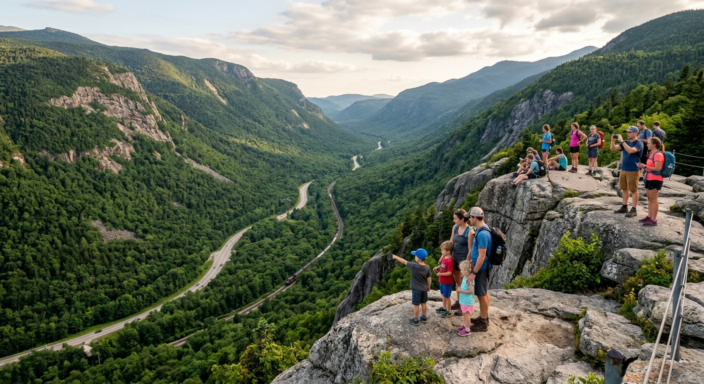
If you've got kids, new hikers, or one spare morning, go here. The trail leaves right from the historic Crawford Depot train station, climbs at a mercifully even grade through the woods, and ends abruptly at a set of cliffs staring straight down the glacial U of Crawford Notch. It's the kind of view that makes people gasp out loud. There's no summit scramble, no exposure on the way up, and the ledges are broad enough to spread out a picnic.
Go early or on a weekday if you can; the depot lot is small. And keep a hand on small kids at the top — the viewpoint is flat, but the drop beyond it is real.
Weather, Huts, and the Stuff That Keeps You Out of Trouble
A few things worth drilling in before your first trip up high:
- Treat the forecast as gospel. The Mount Washington Observatory posts a higher summits forecast every morning. If it says 60 mph gusts and freezing fog above 5,000 feet, believe it, even when Pinkham Notch is sunny and 75. The valley forecast means nothing up top.
- Think of the AMC huts as high-alpine safe harbors. Greenleaf, Lakes of the Clouds, and Madison Spring huts all sit near these routes. Day hikers can walk in for snacks, water, weather updates, and a roof during a squall — no reservation needed for that. (Overnights book out months ahead.)
- Know where to pay. WMNF-managed trailheads with facilities (like the Ammonoosuc Ravine lot) take a five-dollar day pass, while Appalachia is free. Franconia Notch is state park land with its own peak-day reservation system, and Pinkham Notch has free parking at the AMC visitor center.
- Start early. Earlier than that. Every classic trailhead in this list fills between 6:30 and 8 a.m. on summer weekends. The alpine start also buys you calmer wind and afternoon-thunderstorm insurance.
- Above treeline, cotton kills. It's a cliché because rangers keep having to carry people down.
What to Carry in the Whites
You don't need mountaineering gear for a summer day hike, but the Presidentials punish casual packing more than any range in the East. The non-negotiables:
- A real rain shell and an insulating layer, even in August. A packable puffy earns its keep at Lakes of the Clouds more often than you'd think.
- Wool base layers and socks — Smartwool everything up here. Wet cotton at 5,000 feet is how bad days start.
- Grippy, broken-in footwear. The Whites are wall-to-wall wet granite and root ladders. Salomon trail shoes handle everything short of the Knife Edge; for the bigger talus days a mid boot still makes sense.
- Trekking poles for the descents — Black Diamond poles have a reputation for outliving multiple pairs of shoes. Your knees on the Old Bridle Path will thank you.
- More water than feels reasonable, plus a bottle that survives being dropped on granite — a Hydro Flask collects dents up here and keeps going.
- A 20-30 liter pack with a hip belt — an Osprey daypack fits the layers, the water, and the summit sandwich without fighting you.
- A paper map. Phone batteries die fast in cold wind. REI and EMS both carry the waterproof White Mountains trail maps, and EMS — a New Hampshire original — is a great last-minute stop on the drive up if you've forgotten anything.
One Last Thing
If any of this has you refreshing the weekend forecast, same. And if you're picking up a shell, poles, or new trail shoes before you go, consider shopping through the Epic Outdoor retailer links above — every dollar you spend earns entries into our gear sweepstakes, so the kit you were buying anyway gets you a shot at winning a whole lot more of it. No purchase necessary — see the Official Rules for free entry details. No pressure either way. We'll see you on the ridge — we're the ones eating pie at Greenleaf.